Pages

Wednesday, August 31, 2011

Tropical Storm Katia

[Update:  Tropical Storm Katia became a Category 1 Hurricane Wednesday evening....]

By now many of you who visit this site have noticed a NOAA Tracking widget in the upper right column of the page for Tropical Storm Katia.
Katia (pronounced KAH-tyah according to the National Hurricane Center) became a tropical storm early Tuesday morning after first forming as a tropical depression south of the Cape Verde Islands Monday morning.
The storm is moving over very warm sea surface temperatures and into an area with weaker winds aloft. These factors have allowed Katia to strengthen into a strong tropical storm as of early today.
Further intensification is expected with the storm potentially becoming a hurricane later today. Katia could become a major hurricane by the upcoming weekend as it passes north of the Lesser Antilles.
So, the big question becomes where is Katia headed and will it have an impact on the U.S.?
Beyond the weekend, Katia is expected to continue on a west-northwest track into the southwestern Atlantic before taking a northerly turn.

While the forecast is for Katia eventually to turn and head northward and potentially out to sea, it is certainly possible that the storm brings some impacts to the East Coast or Atlantic Canada later next week.

Also, keep in mind that If one of these upper troughs or dips in the jet stream digs further into the Midwest, then that could favor a more westerly track for Katia bringing it closer to the East coast.

I am not posting this information to make anyone nervous (especially in light of this past weekend's storm surge from Huirricane "Irene") but we are now in the most active period of this years hurricane season and this storm, just like Irene, bears watching.
The good news is that if it does pass near us late next week, we will not be in a period of extremely high tides and we will be well off the new moon.

Welcome to Ocean City, New Jersey

The production company for the movie "Imogene" is back in town and once again Broad Channel has been transformed into the town of Ocean City, New Jersey - "America's Greatest Family Resort"
[Note:  The sign is located on west side of Cross Bay Boulevard just as you come off the Joe Addabo Bridge into the bird sanctuary.]

Wednesday 8/31 10:46 am High Tide

It's only 9:30 am and the 10:46 am high tide is already halfway up 12th Road.

Tuesday, August 30, 2011

Common Sense Prevails.....


Anyone who received a summons for parking on the Cross Bay Boulevard median this morning should take the ticket to the 100th Precinct to have it voided.

Dan Mundy of the Broad Channel Civic Association advised..."...I spoke with the 100 pct commanding officer Capt Olexa regarding the summonses issued . He apologized for the fact that the officers did not use better judgement and brought them in to speak to them about their actions. He also stated that he would be speaking to every officer in the precinct to ensure that this would not happen again. I requested that the summonses be voided at the precinct level, given the circumstances, and he indicated that he did not have the authority do void them and that since the ticked "scandal", that was a big issue within the dept, they were not able to void such summonses at the pct level. I told him that the residents would be looking to their elected officials for help in voiding these summonses....Dan Mundy"

The Captain later advised Dan that "...he received permission to void the summonses--he is at the precinct now and we need to get as many of these summonses over to him as soon as possible."

I should add that this is the first instance that I am aware of with 100th Pct. Police Officers tagging our cars up on the median during high tide times.  Normally it is the city's Traffic Enforcement Agents who issue these type tickets with a complete disdain for the environmental conditions causing the situation.  That being said, any enforcement agent assigned to summons duty in the Broad Channel area should be made acutely aware of our tidal flooding isues prior to being let loose with their summons books.

Of course if you don't have EZPass for you car, it's going to cost you $6.50 to travel the Cross Bay Bridge to void your ticket but that's a story for another time.

How NOT to Win Friends and Influence People!


It's 8:30 am Tuesday morning, August 30, 2011 and the 10 am 6.7' high tide is already rolling onto West 12th Road.  Most of the cars on the lower block have been relocated to the Cross Bay Boulevard median for the duration of the tide.
Unfortunately, RMP 2236 from the 100th Precinct was also busy ticketing the displaced vehicles.


This was just one of at least ten or more vehicles that were ticketed by our "friends" from the 100th Precinct.

One of our neighbors approached the Police Officers and explained that the vehicles were
only parked there temporarily because of the pending high tide.  The response from one of the Officers was simply..."It's not flooded now!" 

Of course, there was one vehicle also parked "illegally" on the median that escaped a summons.


So why did this white Ford Van escape a summons?  Let's take a closer look at the dashboard.


We understand the concept of "professional courtesy" but it does not sit well with residents of Broad Channel who are forced to "relocate" their private vehicles on a continual basis to avoid costly damage to their property.

The issue of resident vehicles being ticketed while temporarily parked on the Cross Bay Boulevard median during high tides is a long standing one, nevertheless, in light of this past weekend's storm surge from Hurricane "Irene", these officers from the 100th Precinct simply served to exacerbate
the misery our town residents are experiencing during the clean-up of this storm!

People are angry over this most incident of ticketing cars on the median during a high tide and we are notifying the Office of the Queens Borough President as well as the Office of Councilman Eric Ulrich (District 32) of this matter requesting that an effort be made to finally resolve this problem.

Sunday, August 28, 2011

Queens Borough President visits W12th Road

Shortly after 3 pm, Queens Borough President Helen Marshall stopped by the house to inquire as to how the residents of W12th Road fared with this morning's storm surge from Hurricane Irene. 
Additionally, I would be remiss if I failed to mention the fact that Queens DOT Commissioner Maura McCarthy was also in contact with me both prior to and after the storm.

Tropical Storm Warning for our area continues...

...TROPICAL STORM WARNING REMAINS IN EFFECT...

...COASTAL HAZARDS...

DESTRUCTIVE SURF FROM HURRICANE IRENE WILL CONTINUE TO PUMMEL THE
ATLANTIC FACING SHORELINES...WITH SEVERE BEACH EROSION AND WASHOVERS
EXPECTED THROUGH TODAY.

...WINDS...

AS TROPICAL STORM IRENE DEPARTS...MAXIMUM WINDS ARE FORECAST TO
BE IN THE 30 TO 40 MPH RANGE WITH GUSTS TO 55 MPH THROUGH LATE
AFTERNOON. WINDS WILL DIMINISH THIS EVENING.

MINOR DAMAGE MAY OCCUR TO OLDER MOBILE HOMES. ISOLATED POWER
OUTAGES WILL BE POSSIBLE.

...STORM SURGE AND STORM TIDE...

GENERALLY 3 TO 7 FEET OF SURGE WAS OBSERVED ACROSS NEW YORK
HARBOR...THE SOUTH SHORE BAYS OF LONG ISLAND AND NEW YORK CITY...
PECONIC AND GARDINERS BAYS...AND LONG ISLAND SOUND THIS MORNING.
TIDAL LEVELS HAVE BEEN RECEDING...WITH THE REMAINING MODERATE TO
MAJOR COASTAL FLOODING OVER WESTERN LONG ISLAND SOUND AND THE
EASTERN SOUTH SHORE BACK BAYS GRADUALLY SUBSIDING THROUGH EARLY
THIS AFTERNOON.

The worst is over....


The barometer is rising, the wind has shifted from the East to the North, the sun is starting to peek through and the fire hydrant in front of the house has reappeared from beneath Jamiaca Bay.
I think the worst is over.  All that's left now is for all of us to get out and survey the damages.

And before I forget, we have a 7' high tide this evening at 9:06 pm!   

Sunday 8/28 - 8 am

The "Sunset Marina" appears to have been breached at this time.
The W11th -W12th Canal is overflowing.
Frank Harnisher's deck and ground area on 11th Road have been breached by the bay.


Sunday 8/28 - 7:30 am storm surge

The end of W12th Road is, once again, a part of Jamiaca Bay!


This is gonna be close!

Sunday 8/28 - 6 am...storm surge...


High Tide is not for another hour.....this picture just about sums thing up here at the end of W12th Road.

Saturday, August 27, 2011

Thanks Guys.....


Just wanted to take a few minutes to to say thanks to some special friends (Donna, MaryAnne, Kathy, Susan and John)  who stopped by in the middle of the high tide and pouring rain to make sure I was okay sitting alone in my house in "downtown" West 12th Road....

Now all we have to worry about is tomorrow morning's high tide! I'm going to grab a few winks so I can be up early to monitor the am tide so I will leave you with this....


Night all!

Pete


Saturday 8/27 - 10 pm

The 7:30 high tide came and went and was unremarkable.  Barometer still falling (29.60") and the winds are picking up coming from the East at 20 mph with gusts to 26 mph. Steady rain falling with intermittent thunderstorms.

Tornado Watch Issued...

BULLETIN - IMMEDIATE BROADCAST REQUESTED
TORNADO WATCH OUTLINE UPDATE FOR WT 812
NWS STORM PREDICTION CENTER NORMAN OK
755 PM EDT SAT AUG 27 2011

TORNADO WATCH 812 IS IN EFFECT UNTIL 500 AM EDT FOR THE
FOLLOWING LOCATIONS


NEW YORK COUNTIES INCLUDED ARE:

BRONX, KINGS, NASSAU, NEW YORK, QUEENS, RICHMOND, ROCKLAND, SUFFOLK AND WESTCHESTER

Saturday 8/27 - 6:30 pm

All West 12th Road resident cars are gone from the block.  The headlights you see towards the top of the street are from a PIX News Van which is setting up.  The reporters stated they intend to park there for the night to "ride out the storm" and document flooding on the street. 

The 7:30 high tide is starting to creep in from the bay at the bottom of W12th Road.  The winds are still light coming from the East at 14mph but the barometer, at 29.72", is falling and the bands of rain are becoming more steady. 


Danny Boy is singing "Goodnight Irene..."


By IKIMULISA LIVINGSTON, ERIN CALABRESE and DOUGLAS MONTERO
With POST WIRE SERVICES


Hell no, we won't go!  

A hardy collection of salty holdouts have vowed to weather the worst Hurricane Irene has to offer and refuse to blow out of town -- despite the mayor's mandatory evacuation orders for their neighborhoods.

"I ain't leaving," said Daniel O'Sullivan, 53, a retired Department of Transportation carpenter from Broad Channel, Queens. "I ain't listening to Bloomberg. Tell Bloomberg I ain't going anyplace. No way I'm moving. What's he going to do, lock me up?"

O'Sullivan refused to board up his windows and said he will take advantage of his oceanfront view on West 14th Road, smack in the middle of the city's evacuation zone.

"I'm going to sit on the back porch and watch the water as the storm comes in," he said.

O'Sullivan believes the mayor's call to evacuate is more about making up for the way the city bungled last winter's big blizzard.

"They're just trying to cover up for that," he said.

Next door, O'Sullivan's neighbor had plastered his own house in boards and fled the storm.

"They just moved here," he said. "They don't know any better."

Down the street, Stacey Walsh, 44, also was hunkering down to weather the storm.

"If we leave, our boats could sink," she said. "I'm scared as hell, but I can't leave my husband by himself."

Another holdout, Igor Birger, 52, has lived in Manhattan Beach, Brooklyn, for nine years and had no plans to flee.

"I don't think it's going to be that big a deal," he said. "I used to live in Russia, and nothing scares us. I have my house. I can't leave it."

Birgir said he is prepared for the worst Irene has to offer.

"I bought flashlights and water. I have cash in my pocket, I have plenty of vodka in my freezer, and a couple of cartons of cigarettes," he said. "We'll be fine . . . I have nowhere to go, no house or friends upstate. "The news people like to scare everyone. What's the big deal?"

Saturday 8/27/2011 11:00 am

With the exception of a light rain, everything is still quiet on W12th Road.  The few residents staying for the duration have already moved their vehicles to high ground.  The remaining parked cars are those of residents preparing to relocate.  The bay is calm with winds out of the East at 7 mph. Also keeping an eye on the barometer which has been holding fairly steady at 29.90".   High Tide is this evening around 7:30 pm.


Hurricane "Irene" - Update


We will start feeling the initial approach of "Irene" later this afternoon and expect tropical storm force winds (39+ mph) to be in our area this evening around 9 pm.


NOAA's wind probability forecast for this storm indicates winds of 75 to 80 mph which is less than the projected 100 mph forecast of just 24 hours ago.

Yes it's a big storm but......

"The storm cannot master its own strength."

Message from Councilman Ulrich's Office

From Councilmember Eric A. Ulrich:

Mayor Bloomberg has ordered a mandatory evacuation of all Zone ‘A’ areas of the City and the Zone B portion of the Rockaway Peninsula, due to the impending arrival of Hurricane Irene.

This means that the ENTIRE PENINSULA & BROAD CHANNEL is now under MANDATORY EVACUATION order, effective immediately, to be completed by 5:00pm on Saturday, August 27.

Rockaway and Broad Channel residents should make whatever preparations necessary to leave in an orderly fashion as soon as possible.  Meanwhile, Governor Cuomo has announced that subways, buses and commuter trains in the city, on Long Island and in the northern suburbs will begin their final runs around noon Saturday. Traffic getting off of the Peninsula is expected to get worse tomorrow and later in the day. Bridges will also have to been shut down due to high winds as the storm progresses.

Residents should also expect high call volumes and longer wait times on NYC311. For this reason, I have decided to OPEN and STAFF my Ozone Park district office all weekend (utility and weather permitting) to assist constituents with any questions and/or issues they may have. The phone number is (718) 738-1083. Remember that JOHN ADAMS HIGH SCHOOL-101-01 ROCKAWAY BLVD, OZONE PARK is the new emergency evacuation center. Please remain calm and DRIVE/TRAVEL SAFELY.

THIS IS A MANDATORY EVACUATION ORDER FOR ALL ROCKAWAY AND BROAD CHANNEL RESIDENTS.

Please forward to your friends, neighbors, and any distribution lists for Rockaway and Broad Channel you may have access to.  Thank you.


Bart Haggerty, Chief of Staff
Councilmember Eric A. Ulrich
District 32, Queens
718-738-1083

Friday, August 26, 2011

Bloomberg Orders Broad Channel Evacuation.....


Mayor Bloomberg has ordered the mandated evacuation of Broad Channel and Rockaway no later than 5:00 p.m, tomorrow afternoon.   

Mayor Bloomberg also announced that the MTA will suspend all bus, train and subway operations at noon tomorrow.   

Hurricane "Irene" - Update (Fri 8/26 9:00 am)


Our area is now under a "Hurricane Watch" meaning that tropical force winds are possible within 48 hours.  That advisory will be updated to a "Hurricane Warning" later today when topical force winds are expected within 36 hours.  Unfortunately, the storm's projected track continues to indicate it will cross over (or very close) to our area.   


Presently, NOAA is forecasting maximum winds of 100 mph as "Irene" travels through our area.
Additionally, a "Flood Watch" has been issued for our area from Saturday evening through Sunday night.
Earlier this morning I received the below email message from Queens Community Board 14....

It would be wise for all Rockaway & Broad Channel residents to top off gas tanks  get batteries for flashlights, charge cell phones.
And stay tuned to radio, TV to see if mayor orders evacuation of Communities in CB14   He will make call between late afternoon and early evening.
Those who live in Broad Channel and Breezy point and other neighborhoods in Rockaway  should call friends on main land and make plans to stay  with them if evacuation is ordered. Do this now!!!

NY1 was on West 12th Road early yesterday morning asking residents about the pending storm.

Thursday, August 25, 2011

Message from Councilman Eric Ulrich...

I received the following email from Councilman Ulrich a few minutes ago.

"Although a mandatory evacuation order has not been issued, residents living in Zone "A" evacuation areas — areas of the city that are most likely to be significantly impacted by Hurricane Irene — i.e. Breezy Point, Broad Channel, and portions of Far Rockaway — Be advised that JOHN ADAMS HIGH SCHOOL (101-02 Rockaway Blvd. in Ozone Park) is your new evacuation center. Aqueduct Racetrack is no longer a OEM designated center. When and if an order is issued, John Adams HS is the place to go".

MTA/DOT Advisories...

With Hurricane Irene tracking towards New York, the MTA said it may close the city’s entire mass transit system this wekend. The decision to stop buses, the subway and trains would be made if high winds and torrential rain became too dangerous to continue service.

Additionally, The New York City Department of Transportation will be suspending Alternate Side Parking Regulations Citywide on Saturday, 8/27/11, and Monday, 8/29/11, due to forecasted inclement weather. Parking meters will also be suspended citywide on these dates.

Hurricane "Irene" - Update

The eyewall of Irene will pass close to the city late Sunday. There is an elevated risk of flooding rain (6 to 12 inches) and damaging winds throughout the metro area including the northern and western suburbs.

Expect significant coastal flooding. Hurricane-force wind gusts (80 mph) are in store, which will lead to downed trees, as well as widespread power outages in outlying areas. Sustained hurricane-force winds are likely on Long Island and in coastal Connecticut. Our coastal area can expect an average storm surge of 3 to 6 feet.

Hurricane "Irene" - Update


Computer models are now placing "Irene" on a path extremely close to or over the mid-Atlantic coast and New York City as a weakening Category 2 hurricane.

On its current forecast path, Irene would spread destructive hurricane-force winds (gusts between 80 to 100 mph) across our area here in New York CityA flooding storm surge will also further inundate the coastline exacerbated by normally expected high tides.  (Note: "Storm surge" refers to the "dome" of ocean water propelled by the winds and low barometric pressure of a hurricane.)
 
If "Irene" follows the present projected course, the storm will be over us around 2pm Sunday afternoon but we will start experiencing wind, rain and flooding well prior to that.
The worst case scenario in terms of flooding storm surge for our area would be "Irene" tracking directly overhead or slightly to the west.  The strongest and most sustained hurricane-force winds will be measured in the immediate vicinity of Irene's center and eastward of center.

Additionally, "Irene" is large (400+ mile wide) and slow-moving storm (15 - 20 mph) which means that we could be looking at several hours of high winds, storm surge and heavy rain.

Wednesday, August 24, 2011

Hurricane "Irene" - Update

At this time it appears the eye wall of Irene will pass to the south and east of the city. However, there is an elevated risk of flooding rain throughout our area. We can expect coastal flooding not unlike that experienced during a strong nor'easter. Strong winds at tropical storm force are in store which can lead to downed trees, as well as power outages.

Unfortunately, the timing of this storm is such that we also have to consider this weekend's tides as we are coming up on a New Moon (Monday 8/29/2011).  High Tide Times and heights for this weekend are:

Saturday:  8/27...7:31 am [5.5'] and 7:45 pm [6.3']
Sunday:    8/28...8:19 am [5.9'] and 8:32 pm [6.6']
Monday:   8/29...9:05 am [6.3'] and 9:18 pm [6.6']

Presently, the storm surge threat from "Irene" will be greatest starting Saturday evening through Sunday.

In addition to clearing your decks/docks of any articles that might be damaged or lost due to high winds, keep in mind where your vehicles are parked this weekend as this storm approaches. 

Tuesday, August 23, 2011

Hurricane "Irene" - Update


Current forecast models are placing "Irene" in our area Sunday evening as a possible Category 1 Hurricane.

Forecast models will become more definite as this week progresses.

Monday, August 22, 2011

Keep an eye on "Irene"....


Irene is destined to strike the Southeast later this week, but should also spread its flooding rain into the Northeast in the following days.

Destructive winds, torrential rain, a flooding storm surge and isolated tornadoes will accompany Irene as the storm strikes the Southeast later this week.

After landfall,  meteorologists are growing increasingly concerned that Irene will continue its track northward through the East Coast.

Flooding rainfall would remain a serious threat and danger to residents on such a path.

Rainfall could range from 10 to 20 inches in a slow-moving tropical system. Even if Irene moves rather quickly through the East Coast, the potential still exists for 4 to 8 inches.

Until that time, the entire East Coast, including our island community here in Broad Channel, should closely monitor the progress of the storm.

Irene's track through the East Coast will also determine the severity of the damaging wind threat. A path farther inland could cause Irene's winds to lessen faster than if the storm were to hug the coastline.

Thursday, August 18, 2011

"IMOGENE" Filming in Broad Channel causing "headaches" for residents...

"IMOGENE" star, Darren Criss (your teenage girls will recognize him from the T.V. show "Glee") as he walked along the streets of Broad Channel earlier this week.
Once again, the Mayor's Office of Media and Entertainment has issued permits to a production company to film a movie on the streets of Broad Channel and once again the residents of Broad Channel are being inconvenienced with a large scale displacement of parking spaces.
The movie in question (this time) is "IMOGENE" is a comedy about a  playwright who stages a suicide in an attempt to win back her ex, only to wind up in the custody of her gambling-addict mother.  The movie is scheduled to be released in 2013.
The production company for this movie will be in Broad Channel through Friday, August 19, 2011.
The excitement surrounding a movie shoot in our neighborhood has been tempered by the fact that the Mayor's Office, in permitting this shoot, has disrupted the lives of many Broad Channel residents because parking has been restricted along Cross Bay Boulevard as well as on East 8th and 9th Roads for the duration of the shoot.


A quick walk around town revealed that the movie company has displaced no less than 75 parking spaces normally utilized by Broad Channel residents on a daily basis.
  
According to their website, "...the New York City Mayor's Office of Media and Entertainment (MOME) streamlines government communications by making more information accessible, leveraging technology to aid in the transparency of government, and by supporting relevant industries in New York City."
The Mayor's Office might want to spend a little less  time "supporting relevant industries in New York City" and a little more time considering the impact such motion picture permit issuances has on a          specific neighborhood.
 
In a small island community such as Broad Channel, with its narrow streets and severely constrained parking, the large scale and week long displacement of resident parking spaces is no small matter.
If parking on your street is disallowed, where do you park your car, especially when close to another hundred residents are also scrambling to find a space? God knows you do not want to park it up on the Cross Bay Boulevard median.
This is an issue that should be addressed by the Civic Association and our local Councilman Eric Ulrich and the District Manager of Community Board 14.  If the city is going to "permit" the wholesale restriction of residential parking access, then some sort of accomodation must be made for those residents who are affected.
Additionally, when construction commences on West 11th, 12th and 13th Roads next summer with the city's flood mitigation project, no permits should be issued by the Mayor's Office for these type of movie shoots until such time as the project is completed and all resident parking spaces restored.

Restricting parking on Cross Bay Boulevard for one or two days is one things, restricting whole stretches of residential streets for a week is quite another.

Wednesday, August 3, 2011

"Shared Space" design for W12th Road - Request for Feedback...

The below "newsletter" was delivered to the mailboxes of every West 12th Road resident earlier this afternoon.

August 3, 2011


Dear Neighbor:
On Friday, July 22, 2011, the West 12th Road Block Association (Mr. John Heaphy, Ms. Sophia Valakis-DiVirgilio and Peter Mahon) met with Queens D.O.T. Commissioner Maura McCarthy and representatives from the RBA design Group at the North Channel Yacht Club to discuss the Flood Mitigation Project here in Broad Channel. The meeting was also attended by residents from West 11th Road and the Broad Channel Civic Association.
The purpose of this meeting was to address the many complaints raised by residents of West 11th and 13th Roads during their recent meetings with DOT and the RBA Group regarding the impact of the proposed street raising on individual property "encroachments" (i.e., decks, stairs, fencings, etc.) as well as the projected loss of individual street parking due to "bump outs" for utility poles.

As a result of those complaints, the RBA Group reviewed the entire project to ascertain what, if anything, could be done to minimize the impacts this project would have on individual property owners and the RBA Group has now presented us with an alternate project design which would incorporate a "Shared Space" concept.                                                                                         

"Shared Space” is a term used to describe a particular streetscape design philosophy primarily aimed at changing the impact of motor traffic in public spaces used by pedestrians which includes two main design criteria:

The reduction/removal of traffic control devices
and,
 The reduction/removal of barriers between pedestrians and vehicles

If the "shared space" concept were implemented on West 12th Road, existing utility poles would remain where they are (although they would likely have to be raised to account for the new height of the street) and there would be no need for "bump outs" which would require a marked reduction in the number of available parking spaces on the block, which would remain available on both side of West 12th Road.  Additionally, all existing fire hydrants on West 12th Road would be moved to the opposite side of the street where the existing poles are located.

The north side of West 12th Road would have a 2 foot "sight disabled" zone to allow for "sight disabled" pedestrian movement on the block delineated by the placement of bollards on that side of the block.

Additionally, because of the width of this innovative "shared space" (29 feet) design there would be fewer encroachment impacts on individual properties as exists with the present street/sidewalk plan which is 32 feet wide.


The use of the "shared space" design would also provide a wider available center of the "shared space" to allow a more unobstructed movement of emergency vehicles and sanitation trucks on the block.

The design philosophy states that these design treatments enable reduced vehicle speeds due to drivers no longer assuming they have priority and being forced to be aware of other road users. The reduced speed and increased awareness results in an "environment of care" where the use of the space is more balanced between all road users.

As an aside, DOT has stated that should the "shared space" design be accepted by the residents of West 12th Road, they would also reconfigure the top end (Cross Bay Boulevard) access to our block in a manner which would ensure all entering vehicles are slowed to an appropriate speed and made aware that they are entering on to a "shared space" street.

The claimed benefits of shared space schemes are wide and varied including improved pedestrian amenity, increased vibrancy of the street environment, increased use of the shared space by pedestrians, reduced vehicle speeds, reduced accident rates and increased property values.

Very simply put, West 12th Road would no longer have a "street" per se, "sidewalks" or "curbs". In their place would be a "shared space", a single level 29' wide concrete pad which would be "shared" by cars, bicycles and pedestrians alike.

Shared space removes the traditional segregation of motor vehicles, pedestrians and other road users. Conventional road priority management systems and devices such as curbs, lines, signs and signals are replaced with an integrated, people-oriented understanding of public space, such that walking, cycling, shopping and driving cars become integrated activities.

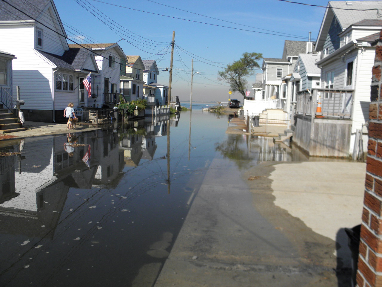
This "shared space" would be "reverse crowned" providing center drainage thus eliminating any ponding near properties. The "shared space" can be designed by "scoring" the concrete and sections of the space can be tinted to delineate free space adjacent to properties to prevent parking directly next to a property.

Does any of this sound familiar? Commissioner McCarthy noted that on West 12th Road "...everybody walks in the street and parks their cars on the sidewalk." We have actually been utilizing the "shared space" concept as a means of accommodating pedestrians, bicyclists, children and cars on our narrow streets for years! Think about it....most large parking lots — for example, those at shopping centers and other stores — effectively function in ways that are very similar to shared spaces on European shopping streets. We have been operating in shared spaces — if drab ones — for decades, without being aware of it.

Initially, this proposal looked very promising; nevertheless, we spent the past two weeks investigating this "shared space" design concept and reached out to various communities, both in the United States and Europe, who presently live with such a design to obtain their feedback.

For the most part, all responses to our inquiries were very favorable, citing an “…increased sense of well-being and familiarity among neighbors…” as well as an “enhanced aesthetics on the street.”

When we first started out with our review we thought the greatest complaints would be regarding a lessening of safety in the area due to the comingling of pedestrians and vehicles.  We quickly realized that was not the case.  In all cases, it was reported that the level of accidents (where they existed previously) dropped markedly.  Apparently once everyone was aware of the fact that they were sharing a space with others, their behavior “calmed” to accommodate such sharing.

Several objections were raised to the concept primarily by advocate organizations for the disabled, especially the blind.  In the majority of these instances, the objections arose as a result of street planners not designing the shared space to account for such disability.  Those shared space streets where such accommodations existed, the complaints were nonexistent. The design for West 12th Road has such accommodation in the form of a bollard enclosed space for the visually impaired.

The second greatest complaint we received was that since the shared space concept was put in place motor vehicles are taking over. They are systematically destroying the pedestrian-friendly furniture and trees. They are increasingly clogging up the street, and making pedestrians more wary of having to deal with traffic. In each of these instances, unlike West 12th Road (a “dead end street), the shared space existed on a through street with a busy traffic pattern.
An informal review was conducted of vehicle usage on West 12th Road which found that traffic movement on the block is busiest:
Between the hours of 6:00 am and 8:00 am, Monday to Friday with parked vehicles exiting the
block, and,

between the hours of 4:00 pm and 6:00 pm, Monday to Friday, with vehicles returning and parking on West 12th Road.

Even during the above times of “busy traffic”, there is no “through” traffic and the vehicle operators are all residents of West 12th Road who are well aware of the possible presence of adults and (especially) children on our street and drive accordingly.

The above notwithstanding, there are still two areas of concern that we are looking into:
1.       A copy of this letter and all information pertaining to this design will be delivered to Chief Dan McIntyre of the Broad Channel Volunteer Department to obtain his assessment of this matter, and,
2.      when we next meet with the city we will inquire how these “improvements” will be viewed by the city regarding possible increased property assessments.
Aside from the above two issues, we tend to agree with DOT’s assessment that the shared space design for West 12th Road will result in “increased safety, no bump outs resulting from moved utility poles resulting in decreased parking, fewer impacts to decks, stairs, walls (Encroachments), improved aesthetics, more flexible use of space, and a sense of place.”
Please think about this issue and let us know how you feel about this “shared space” design project for West 12th Road.  It is important that when we meet with the city that we speak for all the residents of our block.  You can email us at W12thrdblockassociation@gmail.com or call me at my number below.  I am home most days so it is also fine if you just stop by for a cup of coffee!

Peter J. Mahon
for
The West12th Road Block Association
55 West 12th Road
Broad Channel, N.Y. 11693
Home: 945-0805
Cell: 347-821-9656

Tuesday, August 2, 2011

Social Security Offices to close a Half Hour Early.....

Social Security Field Offices to Begin Closing to the Public a Half Hour Early
Congressional Budget Cuts Force Reduced Public Hours
Effective August 15, 2011, Social Security field offices nationwide will close to the public 30 minutes early each day. For example, a field office that is usually open to the public Monday through Friday from 9 a.m. to 4 p.m. will close daily at 3:30 p.m.
  
“While agency employees will continue to work their regular hours, this shorter public window will allow us to complete face-to-face service with the visiting public without incurring the cost of overtime for our employees,” said Michael J. Astrue, Commissioner of Social Security. “Congress provided our agency with nearly $1 billion less than the President requested for our budget this fiscal year, which makes it impossible for us to provide the amount of overtime needed to handle service to the public as we have in the past.”
  
Most Social Security services do not require a visit to an office. For example, anyone wishing to apply for benefits, sign up for direct deposit, replace a Medicare card, obtain a proof of income letter or inform us of a change of address or telephone number may do so at www.socialsecurity.gov or by dialing our toll-free number: 1-800-772-1213 (TTY 1-800-325-0778).

The nearest Social Security Field Office to Broad Channel is located at 617 Beach 20th Street, Far Rockaway, NY 11691,  with present hours of operation from 8:30 am to 4:00 pm.  Effective August 15th, these hours will change to 8:30 am to 3:30 pm.             

Monday, August 1, 2011

More on Peninsula Hospital

To:  West 12th Road Block Association,

Thank you for sharing your concerns regarding the potential closure of Peninsula Hospital.  The Borough President shares your concerns and is committed to working with the Governor’s Office, the local elected officials and the NYS Department of Health to ensure the provision of accessible and quality health care services for the residents of the Rockaways.

I have attached the Borough President’s letter to the State Health Commissioner to this email for your information.

Should you have additional questions or wish to discuss this issue in greater detail, you may contact me at any time.

Please be assured of the Borough President’s efforts on behalf of the 100,000 residents of Rockaway.

Regards,
Paola Miceli, MPADirectorHealth & Human Services
Queens Borough President’s Office

Jamaica Bay (and Broad Channel) in the NY Times

Don Riepe, a suntanned 71-year-old who has lived on the bay since 1981 and has held the title of Jamaica Bay guardian for six years, since retiring from the National Parks Service.


July 29, 2011

Jamaica Bay: Wilderness on the Edge


OF all the ways to describe Jamaica Bay — it is the city’s largest open space, it is a perch of choice for more than 300 species of birds, it is that wetland thing you fly above while landing at (or leaving) Kennedy Airport — the most suggestive of its singularity is that it sits within the only national park in the United States you can reach by subway.
       
A giant salt water puddle, pooled over 20,000 acres beneath the leaky eaves of southern Queens and Brooklyn, the bay lies at the far end of the Rockaways A line. And to ride that line from Times Square to Canal Street to Broadway Junction, and then through Ozone Park to Howard Beach and Broad Channel, where suddenly there are marshes offshore and ibises and egrets in the sky, is to understand that with a simple 90-minute trip one can find a wilderness within the city limits.

The bay is “the one place in New York where nature is so dominant that it makes the city a backdrop,” Brad Sewell, an environmental lawyer and blogger, recently wrote.
       
Of course, that backdrop has caused the bay considerable trouble over the years. Since the industrial revolution, it has served as a dumping ground for items that the city does not wish to see: its garbage fills, sewage treatment plants and occasional dead bodies.

But in the past 10 years or so, as the greening of New York has taken hold, an alliance of officials, environmentalists and local advocates has emerged to save the bay from what makes it so distinctive — which is to say, from its condition as a wild place in the country’s biggest city.
       
Today, Jamaica Bay has reached a kind of inflection point, poised between what it is and what it could become.
       
The lush, green cord-grass marshes are still eroding rapidly, but terrapin turtles have returned in such force that just last month, a stubborn bunch blocked a busy runway at Kennedy. Seals have been spotted sunning themselves on shore rocks. Fleets of kayaks are available for day trips. Even Brooklyn hipsters — those self-conscious harbinger birds, arriving early at what’s soon to be in vogue — have been flocking to the summer cabanas that rest along its shores.
       
All this energy reflects a central fact: Jamaica Bay sits at the literal and figurative edge where the natural and the manmade worlds collide. “It’s just a beautiful, natural ecosystem in the middle of this huge metropolitan area,” said Don Riepe, a suntanned 71-year-old who has lived on the bay since 1981 and has held the title of Jamaica Bay guardian for six years, since retiring from the National Parks Service. “I love the smell and the sound of the bay, the calmness of the water, the marine life, the bird life, the seasons.”